CES 2026 NEWS – Robotic mowers have a predictable weakness that manufacturers rarely discuss. LIDAR-based navigation excels under tree cover and in complex yards but struggles in wide open spaces without reference points. RTK positioning works brilliantly in open terrain but bounces unpredictably when satellite signals hit buildings and foliage. Every mower has to pick one approach and accept the limitations.
Until now, apparently.
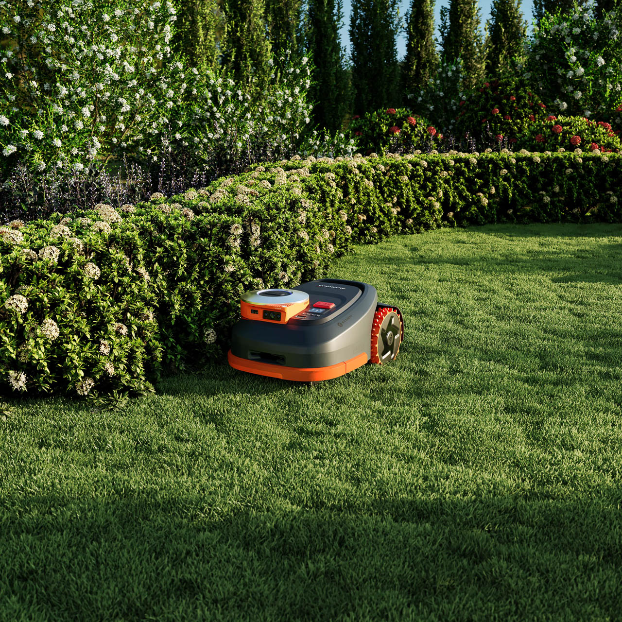
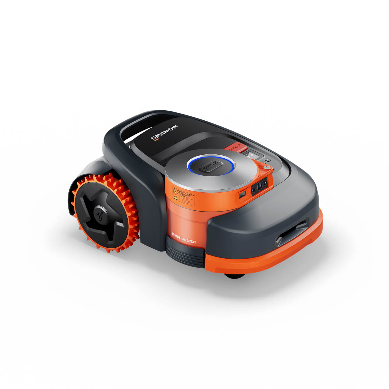
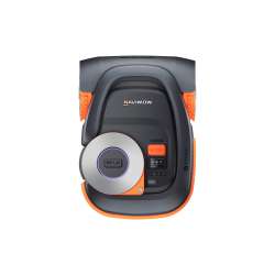
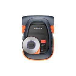
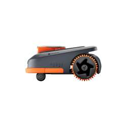
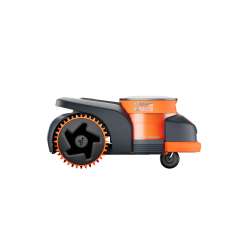
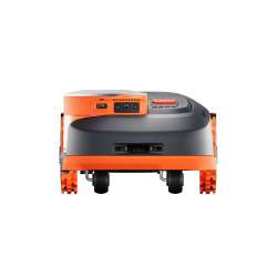
Segway Navimow’s H2 Series, launching at CES 2026, combines both navigation systems in the same machine. The H210 covers quarter-acre properties. The H220 handles half-acre lots. Both use what Segway calls Accurate Triple Positioning: LIDAR for complex areas, Network RTK for open terrain, and sensor fusion that switches between them based on conditions.
If the system works as described, it eliminates the trade-off that currently defines robotic mower purchases.
Add The Gadgeteer as a preferred source to see more of our coverage on Google.
The Navigation Problem Nobody Solved
LIDAR navigation creates high-resolution maps by bouncing light off objects. Trees, fences, and garden structures become reference points that let the mower know exactly where it is. This works beautifully in yards full of features. It fails in open lawns where there’s nothing to reference.
RTK positioning uses satellite signals compared against a reference point to achieve centimeter-level accuracy. This works beautifully in open yards with clear sky visibility. It struggles when signals bounce off structures, pass through foliage, or encounter magnetic interference.
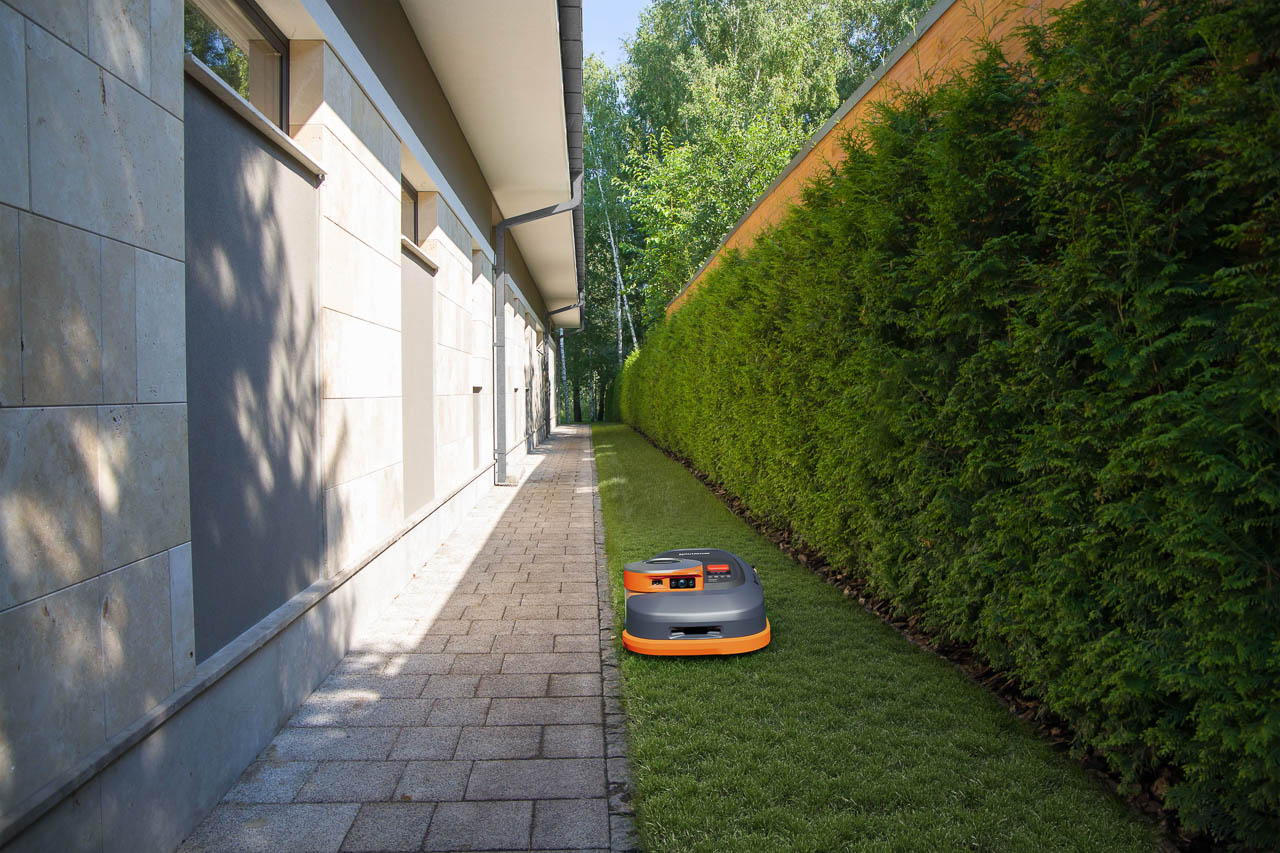
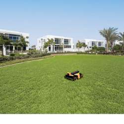
Most homeowners don’t have purely complex or purely open yards. They have both: a tree-covered backyard, an open side yard, a deck that creates shadows, a corner near the garage where nothing works quite right.
Previous robotic mowers forced a choice. The H2 Series doesn’t.
How Dual Navigation Actually Functions
The H2 runs both systems simultaneously rather than choosing one. LIDAR provides continuous environmental awareness. Network RTK provides absolute positioning when satellite conditions allow. The mower’s processing combines both data streams into a single navigation model.

When the mower moves from under a tree canopy into open lawn, RTK positioning becomes primary while LIDAR continues tracking obstacles. When it enters a shaded corner where RTK degrades, LIDAR takes over navigation while RTK provides supplementary data. The transition happens without stopping, without recalibrating, without the mower getting confused about where it is.
Electronic stability control monitors the mower’s behavior for signs of navigation uncertainty. If the system detects conflicting data between LIDAR and RTK, it slows the mower and recalculates rather than proceeding with bad information. The 45% slope capability depends on this stability system maintaining control even when terrain tilts dramatically.
We’ve covered single-navigation failures extensively. The H2 represents the first consumer mower that doesn’t require choosing between approaches.
The GeoSketch Mapping Experience
Setup begins with the same GeoSketch 3D interface that other 2026 Navimow models use. You see your property from above as an interactive satellite-style view, tap to create boundaries, and draw no-mow zones with your finger.

The difference for the H2 is that both navigation systems map your property during the initial perimeter walk. LIDAR captures structural features. RTK captures absolute coordinates. The combined map contains more positioning data than either system alone would provide.
Imagine walking the mower around your yard once and having it understand both the shape of objects and their GPS coordinates. Future mowing sessions can reference either data type depending on conditions. The map doesn’t degrade when satellite signals get weak because LIDAR data remains accurate.
Performance Specifications That Matter
The H210 and H220 share the same navigation technology at different coverage scales. Quarter-acre and half-acre capacities position these mowers for larger suburban properties where yard complexity varies across zones.
Cut height ranges from 2 to 4 inches, covering most North American grass types including the taller varieties common in southern states. The wider cut range compared to smaller Navimow models reflects the H2’s positioning for larger, more diverse properties.
Slope handling reaches 45% grade with multi-directional stability. The mower can approach steep sections from any angle rather than requiring specific attack paths. For yards with drainage swales or berms, this means comprehensive coverage without manual intervention.
Why This Exists
The H2 represents Segway Navimow’s second generation. The original H series established their market presence in Europe. This update responds to feedback that single-navigation systems created predictable dead zones in mixed-terrain yards.
American yards posed particular challenges because property layouts here combine features that European yards typically separate. A single American property might include tree cover, open lawn, building proximity, and slope variation that European products never encountered together.
The dual-navigation approach required processing power that previous generations couldn’t support at consumer price points. Moore’s Law made the combination viable. Competition in the robotic mower market made it necessary.
Who Should Skip This
If your yard is entirely open lawn without trees or structures, you’re paying for LIDAR capability you won’t use. The simpler i2 AWD series offers network RTK at lower cost.
If your property has dense, complex landscaping with minimal open areas, the i2 LIDAR series optimizes for that environment without the RTK overhead.
If your yard exceeds half an acre, the H220’s coverage limit won’t suffice. The X4 series handles larger properties.
And if you’ve been satisfied with a simpler mower’s performance, the H2’s dual navigation solves problems you may not have. The technology matters most for yards that consistently confuse single-system mowers.
What This Signals
The H2 Series positions dual navigation as the answer for properties that don’t fit neatly into LIDAR-optimal or RTK-optimal categories. If adoption follows Segway’s expectations, competitors will face pressure to match the combined approach rather than optimizing for one environment type.
Pre-orders open January 16, 2026, through us.navimo.com and 200+ independent outdoor power equipment dealers. CES demonstrations at booth #9615A will provide hands-on opportunity to see how the navigation switching actually works.
The question isn’t whether dual navigation is technically superior. It’s whether the complexity premium justifies the price for homeowners whose single-system mowers work well enough.
📡 CES 2026 Coverage
Want more from the show floor?
We’re covering the biggest announcements, wildest concepts, and gear that actually matters from CES 2026.

2-Pack LED Video Light Kit, NiceVeedi Studio Light, 2800-6500K Dimmable Photography Lighting Kit with Tripod Stand&Phone Holder, 73" Stream Light for Video Recording, Game Streaming, YouTube
(as of April 8, 2026 19:23 GMT -05:00 - More infoProduct prices and availability are accurate as of the date/time indicated and are subject to change. Any price and availability information displayed on [relevant Amazon Site(s), as applicable] at the time of purchase will apply to the purchase of this product.)