 On May 2 2000 the US Government under Bill Clinton change the status of Selective Availability on their Global Positioning System (GPS) and overnight twenty-four satellites around the globe instantly gave GPS technology an increase in accuracy of approximately 10 fold. Previously a high quality signal was used for military purposes while a lower quality signal was used for civilian purposes ( accurate to around 100m ) Within days, civilians were finding new uses for their much more accurate GPSs. On May 3 2000 Dave Ulmer wanted to test the accuracy of his unit and hid a large black bucket in the woods and posted on a GPS newsgroup calling it the “Great American GPS Stash Hunt”. The rules “Take some stuff, leave some stuff” and from there the sport of Geocaching was born. There are now geocaches in over 100 countries over the 7 continents including Antarctica, over 1.5 million geocaches and over 5 million geocachers in the world.
With most smartphones ( whatever platform ) now having GPS build in, Geocaching has never been easier. Let’s see how C:Geo for Android works.
Caching used to be quite tedious and involved quite a lot of pre-planning for the area you were going to cache in. Writing out co-ordinates and descriptions, getting maps, inputting into your GPS, finding the cache, logging the find when you got back home. While tools like GSAK ( Geocaching Swiss Army Knife ) are great, it still means having to download files and upload them to your GPS , and often you didn’t get the full cache information on your GPS, just the co-ordinates. With built in GPS and data connectivity capabilities on smartphones realtime paperless caching is now a reality and easy.
c:geo is a free app available from the Android Market. The only other thing you’ll need is a geocaching.com user name and password. It’s free for everything you’ll need to get c:geo going and c:geo downloads live information from geocaching.com as default. The first thing you’ll need to do is enter your geocaching.com user name and password. The program also supports GCVote and Go 4 Cache, two sites I don’t use, and you can also publish a new Twitter status every time you log a cache.
Once started you’re then faced with a number of options:
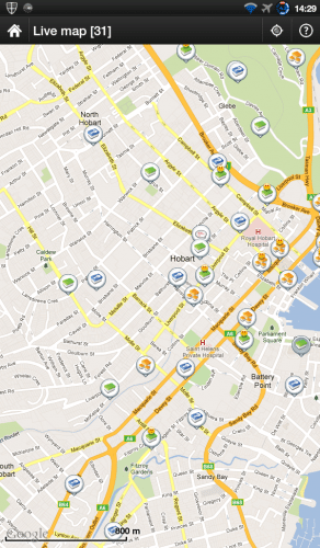
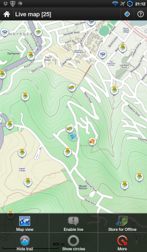
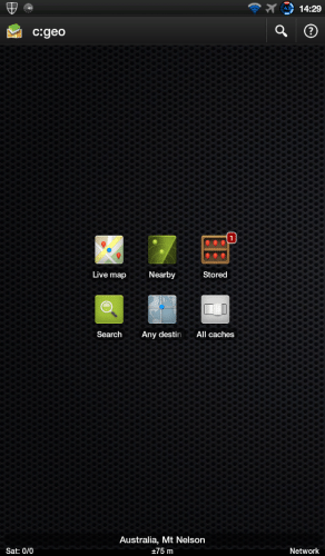 Live map is just that, from the GPS it establishes your position, brings up the appropriate Google or OSM map ( including a terrain map so you can see that huge ravine in between you and the GZ ) and indicates all the caches around you. This is pretty much the only option you really need in c:geo.
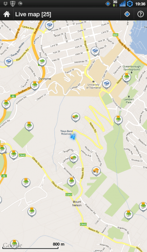 The blue arrow is my position. For those of you who aren’t into geocaching, the green markers are traditional caches, so that location will take you straight to the cache ( GZ or Goal Zone ). The ones with smiley faces are the ones that I’ve found and the stars, caches I own and have hidden. The blue caches are mystery caches, there’s a puzzle that you have to solve before you can actually get to the final GZ. The yellow ones are multi caches, you’ll generally have to go to a number of places to gather information before you’ll actually find the final GZ. The caches can be anything from a micro cache ( a small magnetic cache with just a roll of paper in it ) to garbage bin size containers.
Clicking on one of the caches will bring up some basic details on that cache:
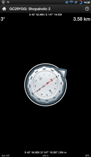
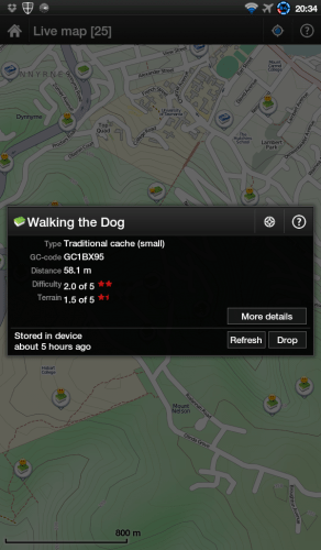 This will often be enough to get you to the cache. You can see there’s an indication of the sort of terrain and how easy it should be to find the cache. Walk/Drive/Cycle till your blue arrow’s on top of the cache and you should be within metres of the GZ. Accuracy will depend on a number of factors mostly the accuracy of the GPS in the device you’re using and also the ability to be able to see the satellites properly. GPSs’ are often more inaccurate when in a city with tall towers or in a forest with lots of tree coverage. If you click the symbol next to the help icon you’ll get a compass that can assist in leading you to the cache. Don’t forget though that the distance indicated on this page is “as the crow flys”, there may be obstacles such as buildings, rivers and gullies between you and the GZ.
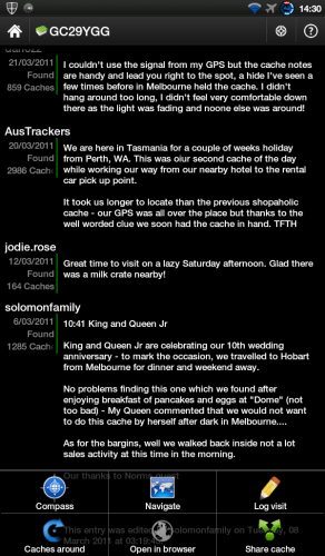
If you need more information, you can click more details and c:geo will go out to geocaching.com to get all the details on the cache. This will include hints if available and also all the logs for the cache. Be warned that logs may also include hints/clues on the location of the cache. This may be useful or a spoiler.
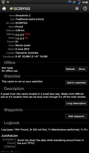 Once you’ve found the cache you can log your visit in real time.
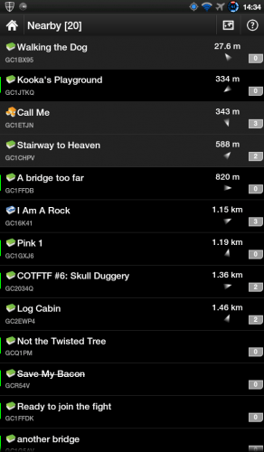
Back to the main screen, “Nearby” gives you a “textual” list of nearby caches:
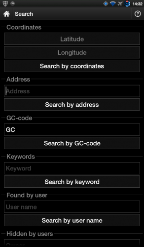
 “Search” allows you to search via a number of different criteria:
All the information so far depends on having an active data connection. Often caches are located in areas where there’s no data connectivity. To facilitate this c:geo has the capability of storing maps and cache information on local storage. Of course this requires some pre-planning but can be a very useful function. By bringing up a live map of the area you’re interested in while having data connectivity you can store both the map and all the cache information locally. So you have full access to all the information you’d normally have available online. The only limitation is that your map will only be stored at the magnification level you saved at so you won’t be able to zoom in or out for more or less detail. You can also import a GPX file ( a local file of cache details ) into cgeo using the Stored cache icon and download OSM offline maps if required though this is probably more aimed towards the more dedicated cacher.
There’s not really a lot that c:geo doesn’t have or do for the casual cacher or the serious cacher.
The only functionality that seems to be missing is the ability to enter additional “child” waypoints for multicaches and trackable logging is only available when online. There is also no way to export logs or cache details.
These days I don’t seriously geocache but I often find myself waiting for my kids to finish an activity or waiting for the wife, and I’ll just bring up the live map view to see if there’s any caches nearby that I can do to fill in time.
The other fun thing is to plan a “treasure hunt” with the kids. If you tell the kids you’re going for a 3 hour walk there’s most likely no way you’ll get them involved, but once you get them on a “treasure hunt” it’s easy. There’s often small toys as swappables in the caches and the kids love it.
If you’re into photography, many caches are hidden by cachers in picturesque places that you’d never find yourself .
If you’ve got an Android device with GPS and data connectivity why not grab a copy of c:geo, sign up on geocaching.com and get out there and give it a go, it’ll cost you nothing.
If you don’t have an Android smartphone, have a look around and see what apps are out there for your platform, it’s fun and a great way to keep fit and see places you normally wouldn’t see.
Garmin Drive™ 53 GPS Navigator, High-Resolution Touchscreen, Simple On-Screen Menus and Easy-to-See Maps, Driver Alerts
33% OffBouncie GPS Tracker for Vehicles with Real-Time Location, Route History, Speed Monitoring, Geo-Fence & Accident Notifications - for Fleets & Family - Cancel Anytime
$89.99 (as of 01/01/2026 00:32 GMT -06:00 - More infoProduct prices and availability are accurate as of the date/time indicated and are subject to change. Any price and availability information displayed on [relevant Amazon Site(s), as applicable] at the time of purchase will apply to the purchase of this product.)Product Information
| Price: | Free |
| Manufacturer: | cgeo open source |
| Requirements: |
|
| Pros: |
|
| Cons: |
|



Gadgeteer Comment Policy - Please read before commenting
My children and I have been geocahing for years. I have run the gambit of add on devices for my Palm (yes, that long), stand alone gps units, and now we do it all with my Droid and c:geo. It really is a great way to get outside and get moving. Whenever we travel in the car, pee/snack/stretch breaks are also geocahing breaks.
We’re just getting into geocaching. It lets us get outside and spend time with the kids. We’ve been using Qollector for the iPad to track our own cache’s as well as documenting existing locations. We include photos and videos when we discover a new geocache. It was quick to design everything in Qollector.
https://qollector.com/p/geocaching
I live in an “old folk’s home”. I have created a geocaching network on our 105 acre property. I am looking for a free app that residents or visitors can download and learn to use easily. The front desk will give players the location of the first cache…which contains the location of the next cache…etc. WE DO NOT WANT THESE LOCATIONS TO BE POSTED ON ANY SITE. WE DO NOT WANT TO KNOW WHAT CACHES ARE AVAILABLE ELSEWHERE. We just want to load a location manually and have a direction indicator and a measure of distance to the cache. Above all, we need simplicity. If I can’t find such an app, I have wasted an awful lot of time!
Hey Stuart
Sorry I didn’t reply earlier, just saw this.
For that sort of basic functionality I’d be looking at something like geocompass (https://play.google.com/store/apps/details?id=sk.mihalovic.geocompass)
Assuming nobody gets the list of co-ordinates that shouldn’t then all would be fine.
Hope this helps.
Cheers.
Ian.