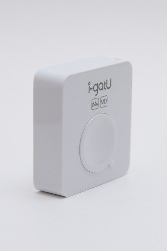
 The MobileAction i-gotU is a small, on-the-go geo-tagging device may look like a tiny paperweight, but it packs a whole lot of feature and comes with three pieces of distinct software (@trip, Where am I and Sports Analyzer) for various utilizations. Whip this plastic box out while traveling to get accurate satellite tagging of your location for photos, exercising and just for kicks!
Out of the box, the i-gotU comes with:
- i-gotU GT-600
- Charging Cable
- Armband
- Translucent Silicon Cover
- Software Disk – mini disk that will not work with most MAC computers
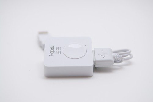
I’ll admit my experience with this device has been rather troubling because it lacks Mac OSX support. Any device that only allows me to use WinXP on Parallels can make me antsy and a bit nervous.
I originally tested the device out back on a trip to Los Angeles at the end of January, only to realize that none of the tags took.
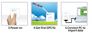
During the trip, I pointed the device at the sky, clicked the white button, saw a blue LED light flash, pressed the button again, thought I saw a blue light and red one, and put the device away. I did this several times along the trip as I took pictures, hoping to later tie the geo-tag to the photo I had taken.
I didn’t bring my Macbook Pro with me to double check it was working properly – big mistake because when I got home, hooked it up and opened the @tripPC program, nothing imported!
I was a tad disappointed, so I decided to reread the instructions and try it again. This time I paid closer attention to the blinking LED lights. Blue means on. Then I pointed the device to the sky till the LEDs blinked red and blue. Pressed the button again, and voila I hoped it worked this time!
Success! It worked! My locations weren’t as exotic, but at least I was able to get the little box to do its job.
FYI, be careful to pay attention to the blinking lights. If the device doesn’t acquire a satellite signal, then you’re just wasting your time!
Features
This blocky white box comes in at 46 x 41.5 x 14 mm and weighs 37g, and is like lugging around a chunky flossing container. Charged up with a 750mAh rechargeable Li-ion battery, you get tons of life before juicing up. It also powers off when not in use, conserving battery life and uses a SiRF Star III 65nm GPS low power chipset that helps save energy.
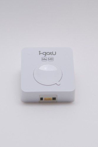
A 64M of onboard flash memory is perfect for tagging up to 262,000 points — good luck trying to fill that up travelers! And don’t worry about dropping this heavy snowflake in the snow or rain, it’s absolutely water resistant!
Software
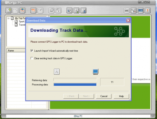
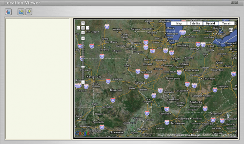
@tripPC is similar to iPhoto in that it geo-tags your photos and places them on a map, and you can share pictures with friends using a mobilemesque gallery interface. MobileAction has some great video walkthrough, tutorial videos on their website that makes using the program very easy.
It would be cool if you could export the geo-tag to the photo for use in other photo organizing software (ie..iPhoto or Aperture), but considering the overall lack of Mac support, it’s probably not going to happen.
Regardless, @trip does make a social sharing effort by letting you create your own personal travel blog and upload your pictures to popular sites like Flickr and Picasa.
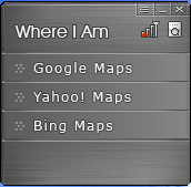
Where Am I? is a simple, straightforward application. Hook the i-gotU up to your computer and it tells you where you’re at. Good for those boinked on the head or those with an odd case of spontaneous amnesia.
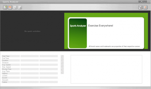
Sports Analyzer takes your fitness to a whole new level with google map exercise routes, calendars and fitness goals, and through a series of different charts and statistics, you get a better grasp of how you are going to maintain or achieve healthy living goals.
Complaints!
I hate to end this review on a sour note, but I can’t gloss over the few glaring complaints I have about the device.
There’s no MAC OSX support! I’m sure i-gotU could make an awesome mac interface, but you’re locked into using the PC to manage everything. I had to flip over to Parallels to manage the i-gotU, so it did not make it super convenient for me to organize and manage my data.
I also had a difficult time wit the proprietary USB cable end. You have to slide it into place in just a way where everything snaps together correctly, and a failure to do so made me worry that I might snap the plastic ends off.
Sorry PC Users…
If you’re an avid PC user, please ignore! It’s a great little device if you lack a geo-tagger on your digital camera, and provides extremely accurate readouts, some detailed and helpful software and user guides, and is a fun to use once you get the hang of it.
But is it worth the $80 price tag? Only if you’re desperate!
Photographs brought to you by: Christopher Tooley –http://WWW.TOPHERPHOTOGRAPHY.COM
FYY Travel Cable Organizer Pouch Electronic Accessories Carry Case Portable Waterproof Double Layers All-in-One Storage Bag for Cord, Charger, Phone, Earphone Black
(as of February 3, 2026 18:33 GMT -06:00 - More infoProduct prices and availability are accurate as of the date/time indicated and are subject to change. Any price and availability information displayed on [relevant Amazon Site(s), as applicable] at the time of purchase will apply to the purchase of this product.)tomtoc Electronics Organizer Travel Case, Water Resistant Travel Bag Cable Organizer for Essentials, Tech Pouch Accessories Carry Storage for Cord, Phone, Cables, Airpods, USB Flash Drive, Daily Items
(as of February 3, 2026 18:33 GMT -06:00 - More infoProduct prices and availability are accurate as of the date/time indicated and are subject to change. Any price and availability information displayed on [relevant Amazon Site(s), as applicable] at the time of purchase will apply to the purchase of this product.)Product Information
| Price: | $119.99 |
| Manufacturer: | MobileAction |
| Pros: |
|
| Cons: |
|



Gadgeteer Comment Policy - Please read before commenting
It’s only the included software which is Windows-specific, these have pretty standard interfaces and I know there is open source software which can talk to them as bluetooth GPS devices and I believe there’s open source software which can read out stored waypoints.
Aha: https://launchpad.net/igotu2gpx
Some googling comes up with various geotagging software available for Mac & Linux (which can use the “gpx” output from the above program).
With one of the automated programs, it’s probably easier to just put the device into continuous logging mode instead of explicitly clicking for each shot you take, assuming its battery can hold out long enough.
thanks Sam for the information. That’s extremely helpful!
I’m thinking about buying the USB 120 igotu, but I have a few questions. The thing is, I was actually looking for a regular USB GPS mouse, when I came across the igotu whit its extra picture logging function. The website and reviews make pretty clear the igotu works as a normal GPS mouse, but no one ever mentions combining its two functions, at the very same time.
My plan is to make a long road trip with GPS utility (navigation software) telling me where I am. During this trip I hope to come across some picture worthy sceneries. I will probably take pictures from the car, without wishing to disconnect the igotu to get it running on its battery. Can I later add locational information to a picture taken while the igotu is USB connected to the computer and used by the navigation software?
If this is the case, does it work because the igotu still stores waypoints on its internal memory, which means it has to be cleared every now and then? Or is it actually possible to have two different software programs communicating with the GPS simultaneously?