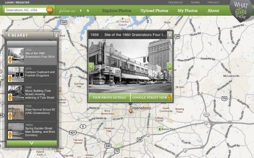
 I’ve lived in Greensboro for many years now, and I’m continually amazed by how it’s changed since I moved here. I often notice a new building as I’m driving along and try to remember what used to be there. Many of the houses in my neighborhood were demolished to make way for a cross-town road many years before I moved here, but I can still see the ghostly remains of cement pathways going up to houses that aren’t there any longer. I’d love to see how my street looked before the “improvements” of the 1950s and 60s. The WhatWasThere website is tying historical photos to Google Maps to give us an eye to the past. Of course, you’ll only be able to see old street views for areas with historical photos, and you can upload your photos to help build the database. Unfortunately, they don’t have any photos of my neighborhood yet, but I was able to see how the nearby college area looked around the turn of the last century. It’s fun looking at these old pictures while sitting at my computer, but there’s also a WhatWasThere app for iPhone that makes your “eye to the past” more immediate. Click the above image for a large view of the Greensboro Woolworth’s store – the site of the Greensboro Sit-ins that were an important part of the early Equal Rights Movement – as it appeared the year before the Sit-ins occurred.
Get a View of the Past with WhatWasThere
We use affiliate links. If you buy something through the links on this page, we may earn a commission at no cost to you. Learn more.
